
On October 24, 2026, the National Weather Service issued a tornado warning for central Otero County, New Mexico. I looked at the storm in WeatherWall using the Holloman Air Force Base radar (KHDX). The red outline shows the tornado warning, but the radar shows very little inside it.

Mountain terrain is a big part of reading radar in this region. A storm can be within a radar’s range and still be partly hidden by terrain. I want to know where that can happen, especially when I am following a storm with a tornado warning.
How mountains block radar
A weather radar sends out a beam and measures the energy that comes back. When a mountain sits in the beam’s path, it can block some or all of that energy. The radar may miss weather behind the mountain or show a weaker return than it would with a clear view.
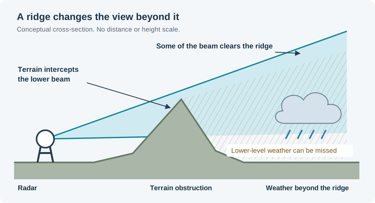
In this illustration, part of the beam passes over the ridge while the lower part is blocked. That can leave the radar with a limited view of the storm beyond it.
See beam blockage in WeatherWall
WeatherWall’s Show Beam Blockage setting puts terrain blockage on the map with your radar data. It gives me a way to check whether terrain might explain a weak or missing radar return.

With beam blockage turned on, we can see that the warning is in an area where terrain affects the radar’s view. This helps explain why the storm is hard to see from KHDX.
Near El Paso, the Franklin Mountains also block portions of the radar coverage over El Paso and Hudspeth Counties. A weak echo in a blocked area could mean light rain, or the radar may have trouble seeing the weather behind the mountains.
Looking higher into the storm
WeatherWall lets us choose a higher radar tilt. At 2.4 degrees, we can see a strong storm inside the warning. This sweep was taken about two minutes after the 0.5-degree view above, as the radar scanned higher into the atmosphere.

The highest tilt in this radar volume is 19.5 degrees. The warning area is outside the roughly 59-kilometer data range of that sweep, so this view cannot tell us whether the storm reaches that height.

If terrain is blocking the view, I can switch to another radar and see whether it has a clearer look at the same area. Rain gauges and surface reports can also tell us more about what is reaching the ground.
Distance matters too. The radar beam rises as it travels, so it can pass over low-level weather even when the path is clear. The blockage overlay helps identify terrain obstructions; it cannot show how much rain the radar missed.
See terrain blockage alongside your radar data in WeatherWall. For more on reading radar data, visit the radar artifacts and limitations guide.